ArcGIS Online: It’s way more than just a map-making tool, you know? Think of it as your all-access pass to a world of geographic information, letting you create stunning maps, analyze complex data, and collaborate with others on projects. We’re talking everything from tracking disease outbreaks to planning urban development – seriously, the possibilities are endless. This guide will walk you through the ins and outs of ArcGIS Online, covering everything from basic functionality to advanced techniques.
Get ready to level up your GIS game!
We’ll explore ArcGIS Online’s core features, from creating maps and managing data to collaborating with others and leveraging its powerful applications. We’ll also delve into the various licensing options and best practices for maximizing your ArcGIS Online experience. Whether you’re a seasoned GIS pro or just starting out, this comprehensive guide will equip you with the knowledge and skills you need to harness the full potential of this amazing platform.
ArcGIS Online Functionality
ArcGIS Online is Esri’s cloud-based mapping and analysis platform, offering a powerful yet accessible way to create, share, and analyze geographic information. It’s designed for a wide range of users, from casual map creators to seasoned GIS professionals, providing tools for everything from simple data visualization to complex spatial analysis. Its core strength lies in its ease of use coupled with robust functionality.ArcGIS Online’s core functionality revolves around creating and sharing maps, apps, and scenes.
Users can upload their own data, access Esri’s vast collection of ready-to-use maps and layers, perform spatial analysis, and collaborate with others on projects. The platform also integrates seamlessly with other Esri products, extending its capabilities significantly. Data visualization is streamlined through a user-friendly interface, making it easy to create compelling and informative maps.
ArcGIS Online User Roles and Permissions
ArcGIS Online employs a tiered system of user roles, each with specific permissions and capabilities. These roles determine what a user can do within the platform, ensuring data security and controlled access. The most common roles include: Viewer, Creator, Editor, and Administrator. Viewers can only see and interact with publicly shared content. Creators can create and share their own content but may have limited editing rights on shared content.
Editors have broader editing privileges and can modify shared content. Administrators have full control over the organization’s ArcGIS Online resources, managing users, data, and settings. This role-based access control is crucial for maintaining data integrity and managing collaboration within teams and organizations.
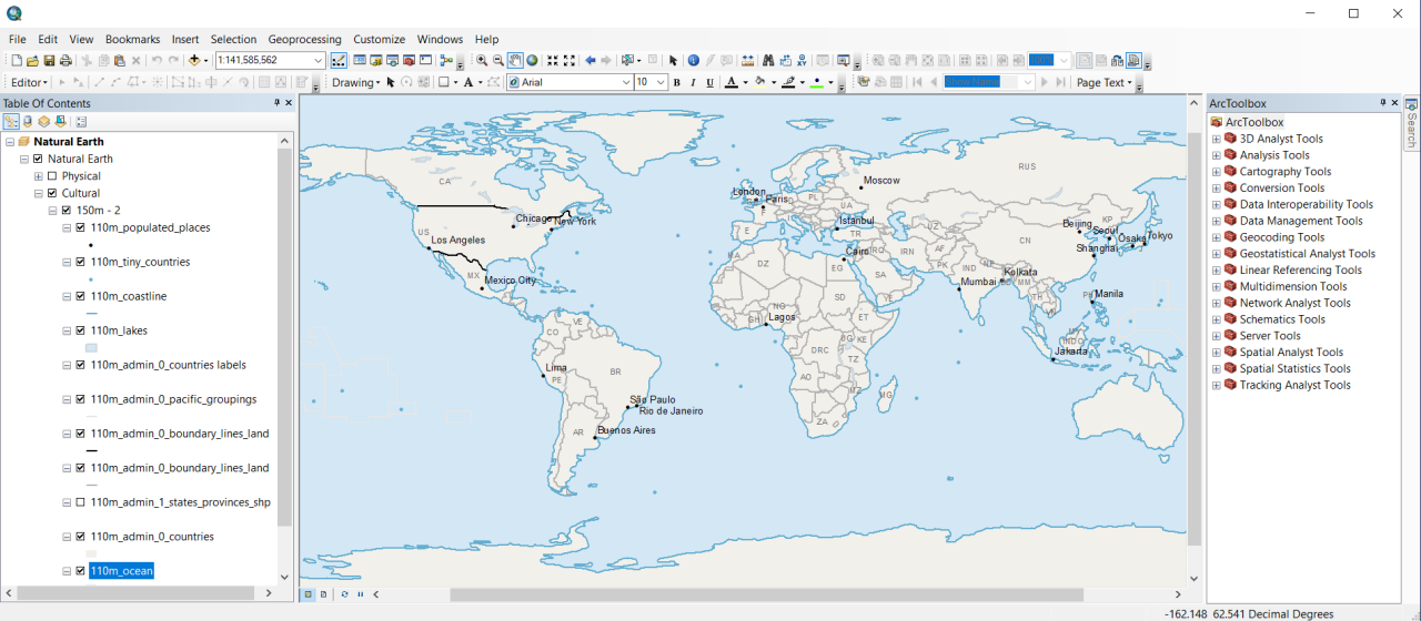
Creating a New Map in ArcGIS Online
Creating a map in ArcGIS Online is a straightforward process. First, log in to your ArcGIS Online account. Then, navigate to the “Map” button, typically located on the main dashboard. Next, you’ll be presented with a blank map canvas. You can add layers to your map by selecting the “Add” button and choosing from various options, including uploading your own data (CSV files, shapefiles, etc.), searching Esri’s Living Atlas of the World for pre-made layers (like roads, boundaries, or imagery), or connecting to other online data sources.
Once layers are added, you can customize the map’s appearance, including symbology, labels, and pop-ups. Finally, save your map and optionally share it with others.
Comparison of ArcGIS Online with Other GIS Platforms
ArcGIS Online competes with other GIS platforms like QGIS (open-source), Google Earth Engine (cloud-based), and Mapbox (cloud-based). Each platform has its strengths and weaknesses. ArcGIS Online excels in its ease of use, extensive library of pre-built content, and robust integration with other Esri products. QGIS, being open-source, offers flexibility and cost-effectiveness, though it might have a steeper learning curve.
Google Earth Engine specializes in large-scale geospatial analysis using satellite imagery, while Mapbox focuses on custom map design and web map development. The best choice depends on specific needs and priorities, considering factors like budget, technical expertise, and the type of geographic data being used. For instance, a large organization might benefit from ArcGIS Online’s comprehensive features and integration capabilities, while an individual researcher might prefer the open-source nature and flexibility of QGIS.
ArcGIS Online Mapping Capabilities

ArcGIS Online offers a robust suite of mapping tools, far beyond simply plotting points on a screen. It allows for the creation of visually appealing and informative maps using various data sources and visualization techniques, making it a powerful tool for communication and analysis. This section will delve into the core mapping capabilities, from choosing the right map type to customizing the visual representation of your data.
Map Types in ArcGIS Online
ArcGIS Online provides a variety of map types, each suited for different purposes and data representations. The choice of map type significantly impacts how your data is perceived and understood. Selecting the appropriate type is crucial for effective communication. Common map types include: Web maps, which are dynamic and interactive; Basemaps, which provide a geographic context; and Scene layers, which are 3D representations of geographic data.
Each map type offers unique functionalities and visual styles, allowing for tailored map creation based on the specific needs of the project. For instance, a web map might be best for displaying spatial relationships between different datasets, while a scene layer would be ideal for visualizing elevation changes or urban landscapes.
Adding Data Layers to a Map
Adding data layers is straightforward in ArcGIS Online. Users can incorporate various data types, including shapefiles, feature services, imagery, and CSV files. The process typically involves navigating to the “Add” button within the map interface, selecting the data source, and specifying the layer’s properties. Data can be added from various sources, such as your computer, cloud storage, or directly from ArcGIS Online’s vast collection of publicly available datasets.
This flexibility allows for the creation of rich and informative maps that integrate multiple perspectives and data sources. For example, adding a layer showing population density alongside a layer depicting crime rates can reveal interesting correlations.
Symbology Options for Map Customization
Symbology is key to effective map communication. ArcGIS Online provides extensive options for customizing the visual representation of your data. These options include choosing different symbols (points, lines, polygons), adjusting colors, sizes, and transparency, and utilizing unique markers to distinguish different features. The selection of appropriate symbology depends heavily on the type of data being displayed and the message the map is trying to convey.
For example, using graduated symbols to represent population density, or different colors to represent different land use categories, enhances the clarity and understanding of the map.
Map Design Showcasing Visualization Techniques
This example demonstrates various visualization techniques using hypothetical data on air quality across a region.
| Technique | Effectiveness |
|---|---|
| Graduated Symbols (representing pollution levels) | Highly effective for showing varying levels of a single variable across a geographic area. Visually intuitive and easy to interpret. |
| Heatmaps (representing pollution concentration) | Effective for displaying density and concentration, especially when dealing with a large number of points. Can be less precise than graduated symbols for individual values. |
| Choropleth Maps (representing pollution levels by administrative unit) | Useful for displaying aggregated data at a regional level. Can mask variations within each unit. |
| Isoline Maps (representing pollution levels using contour lines) | Effective for showing continuous change in a variable, particularly useful for visualizing elevation or pollution gradients. Can be difficult to interpret with complex data. |
ArcGIS Online Data Management
So, you’ve got your maps looking slick in ArcGIS Online, but now the real work begins: managing your data. This isn’t just about throwing files into a digital bin; it’s about organizing, accessing, and sharing your information efficiently and effectively. Think of it as building the foundation for a truly robust GIS project. Proper data management is key to avoiding headaches down the line, and we’re going to cover the essentials.Data management in ArcGIS Online isn’t just about storing files; it’s about establishing a streamlined workflow that ensures data integrity, accessibility, and collaboration.
This involves careful planning and the adoption of best practices, which we’ll explore in detail. Effective data management contributes to improved decision-making and ultimately, successful project outcomes.
Best Practices for Managing Data within ArcGIS Online
Effective data management in ArcGIS Online hinges on several key strategies. First, consistent naming conventions are crucial. Imagine trying to find a specific file among hundreds of haphazardly named files – a nightmare! Establish a clear, logical system, perhaps incorporating project names, dates, and data types. Second, metadata is your friend. Thoroughly documenting your data – its source, accuracy, and purpose – is essential for both you and anyone else who might access it.
Think of it as providing clear instructions for using your data. Finally, regular data backups are non-negotiable. Data loss is a serious threat, and having a reliable backup system ensures you can recover from any unforeseen issues. Consider utilizing ArcGIS Online’s versioning capabilities for tracking changes and reverting to previous states if needed.
Workflow for Importing and Exporting Data
Importing and exporting data in ArcGIS Online is surprisingly straightforward, though the specifics depend on the format. For common formats like shapefiles (.shp), geodatabases (.gdb), and CSV files, the process involves using the “Add Data” function within the ArcGIS Online map viewer. You simply browse to the location of your data and add it to your map. Exporting is similarly simple.
You can download your data in various formats directly from the item details page of your hosted feature layers or feature services. For more complex data formats or larger datasets, consider using ArcGIS Pro for pre-processing and then publishing to ArcGIS Online for enhanced management and collaboration.
Data Storage Options in ArcGIS Online
ArcGIS Online offers several ways to store your data. The most common is using hosted feature layers. These are essentially feature classes stored and managed by ArcGIS Online. They’re easy to use, automatically support collaboration, and benefit from ArcGIS Online’s built-in tools. Alternatively, you can register your own existing feature services, allowing you to integrate data from other sources.
Finally, you can utilize ArcGIS Online’s file storage capabilities for storing supporting documents, images, and other related files.
Limitations of Data Storage in ArcGIS Online
While ArcGIS Online offers a convenient platform for data management, it’s crucial to understand its limitations. Storage capacity is limited by your ArcGIS Online subscription level. Large datasets might require significant storage space, potentially exceeding your allocated quota. Furthermore, processing intensive operations, such as complex spatial analyses, might be slower than performing them on a local machine or a dedicated server.
The system is optimized for web-based access and collaboration, so there are inherent trade-offs regarding performance for very large datasets or computationally demanding tasks. Also, remember that ArcGIS Online is a cloud-based service, meaning you are reliant on internet connectivity to access your data.
ArcGIS Online Collaboration and Sharing
ArcGIS Online isn’t just about individual map-making; it’s a powerful platform for teamwork and knowledge sharing. Imagine a scenario where multiple departments within a city government need to collaborate on a project to assess flood risk. This requires integrating data from various sources – hydrological models from engineering, property data from assessment, and social vulnerability data from community services.
ArcGIS Online provides the collaborative framework to bring all this together.Effective collaboration hinges on seamless data sharing and efficient communication. ArcGIS Online offers several options for sharing your work, each with specific implications for access and control. Understanding these options is crucial for successful collaborative projects.
Sharing Options and Their Implications
ArcGIS Online offers a tiered system for sharing your GIS resources. You can share publicly, with specific organizations, or with individual users and groups. Public sharing makes your content visible to anyone on the internet. This is great for open data initiatives but requires careful consideration of data sensitivity and privacy. Organization-level sharing restricts access to members of your organization, ensuring internal data security.
Sharing with specific users or groups allows for granular control, enabling targeted collaboration within a defined team or project. The implications are clear: public sharing maximizes reach but minimizes control, while sharing with specific groups offers tailored collaboration with enhanced security.
Creating and Managing Groups in ArcGIS Online
Creating and managing groups is fundamental to collaborative workflows in ArcGIS Online. Groups act as containers for shared resources, allowing for focused collaboration around specific projects or themes. To create a group, you’ll navigate to the “Groups” tab in your ArcGIS Online account. You’ll then provide a group name, description, and specify its purpose and membership settings (public, private, or organization-only).
Managing a group involves adding and removing members, updating group settings, and moderating content shared within the group. This controlled environment promotes focused teamwork and streamlined communication.
Sharing a Map with Specific Users or Groups
Sharing a map with specific users or groups is straightforward. Once you’ve created a map, open its item details page. Locate the “Sharing” section. Here, you’ll see options to change the sharing level from private to “Groups” or “Users”. Selecting “Groups” allows you to specify the group(s) you want to share the map with.
Selecting “Users” lets you add individual ArcGIS Online users by searching their usernames. After selecting your intended recipients, you’ll confirm the share. Remember to consider the permissions granted (viewer, editor, etc.) to ensure the right level of access for each user or group. This granular control empowers effective collaboration while safeguarding data integrity.
ArcGIS Online Applications and Widgets

ArcGIS Online offers a suite of pre-built applications and customizable widgets that significantly enhance its mapping and data management capabilities. These tools allow users of varying technical expertise to create engaging and interactive web maps and apps without needing extensive coding skills. Understanding these applications and widgets is key to leveraging the full potential of the ArcGIS Online platform.
Pre-built ArcGIS Online Applications
ArcGIS Online provides a range of ready-to-use application templates, each designed for specific purposes. These templates streamline the app creation process, allowing users to quickly deploy functional applications tailored to their needs. Selecting the right template depends on the intended use and desired functionality.
- Operations Dashboard: This application is ideal for monitoring real-time data and displaying key performance indicators (KPIs). Imagine a city using it to track traffic flow, emergency response times, or air quality levels in real-time, presenting this information visually through charts and gauges.
- Story Maps: Story Maps are perfect for creating compelling narratives around geographic data. For example, a historian could use a Story Map to showcase the evolution of a city, combining maps, images, and text to tell a rich and engaging story.
- Web AppBuilder: This is a powerful tool that allows for the creation of custom web applications using a drag-and-drop interface. It simplifies the process of incorporating widgets and configuring application behavior, enabling the construction of applications tailored to unique requirements.
- Explorer: Explorer is a simple yet effective application for exploring geographic data. It allows users to easily navigate and interact with maps, making it suitable for basic data visualization and exploration tasks. A park ranger might use it to create an app showing hiking trails and points of interest within a national park.
ArcGIS Online Widget Functionality and Use Cases
Widgets are interactive components that add specific functionality to web applications built within ArcGIS Online. They enhance user experience by providing tools for navigation, analysis, and data interaction. Effective widget selection greatly improves the usability and effectiveness of a custom application.
- Legend Widget: Displays the map’s legend, allowing users to understand the symbology used on the map. This is crucial for interpreting the map’s content.
- Search Widget: Enables users to search for locations and features on the map using s or addresses. This is essential for user navigation and data discovery.
- Basemap Gallery Widget: Allows users to switch between different basemaps (e.g., topographic, imagery, streets) to view the data in different contexts. This improves the map’s context and visual appeal.
- Measurement Widget: Enables users to measure distances and areas on the map. This is useful for tasks such as calculating land area or determining distances between locations.
- Attribute Table Widget: Provides access to the attribute data associated with features on the map, enabling detailed data analysis and exploration. A real estate app could use this to display property details directly on the map.
Designing a Custom Application Using ArcGIS Online’s API
Building a custom application using ArcGIS Online’s JavaScript API requires programming skills. The API provides a comprehensive set of tools and functionalities to interact with ArcGIS Online services and create sophisticated web mapping applications. A hypothetical example might involve creating a real-time wildfire tracking application that pulls data from various sources and displays it on a dynamic map, allowing users to monitor the spread of the fire and view evacuation zones.
This application could incorporate custom widgets and visualizations not found in pre-built templates. The API’s flexibility allows developers to tailor the application precisely to their needs.
Comparing Different Application Templates in ArcGIS Online
A presentation comparing different ArcGIS Online application templates would highlight their strengths and weaknesses, guiding users towards the best choice for their specific needs. The presentation could use screenshots and examples to illustrate the capabilities of each template, emphasizing features like data visualization options, interactivity levels, and ease of use. A table summarizing key features and ideal use cases for each template would be a valuable component.
For example, a comparison could show that Operations Dashboard excels in real-time monitoring while Story Maps are best suited for narrative-driven presentations. This comparative analysis helps users make informed decisions when selecting the most appropriate application template for their project.
ArcGIS Online Security and Access Control
ArcGIS Online offers a robust suite of security features designed to protect your valuable geospatial data and ensure only authorized users can access and manipulate it. Understanding and implementing these features is crucial for maintaining data integrity and compliance with relevant regulations. This section will delve into the specifics of ArcGIS Online’s security model and provide practical guidance on securing your data.
ArcGIS Online’s security architecture is built upon a foundation of roles, permissions, and access control lists (ACLs). These mechanisms work together to define who can access specific items, what actions they can perform, and how data is shared within your organization or with external collaborators. Effective security management requires a proactive approach, encompassing careful planning, consistent monitoring, and regular updates to security settings.
Access Control Lists (ACLs) and Their Implementation
ACLs are the core of ArcGIS Online’s access control system. They determine who can access specific items—like maps, layers, apps, and feature services—and what level of access they have. Each item has its own ACL, allowing for granular control over permissions. Implementing ACLs involves assigning specific roles (Viewer, Editor, Publisher, etc.) to individual users or groups. For example, a group of field technicians might be granted Editor access to a specific feature service representing utility infrastructure, allowing them to update field data but not delete or modify the service’s underlying structure.
Meanwhile, a group of data analysts might have only Viewer access to ensure data integrity. The process of assigning these roles and permissions is managed through the ArcGIS Online administration interface, offering a user-friendly, yet powerful, system for managing access. Consider regularly reviewing and updating ACLs as roles and responsibilities within your organization evolve.
Protecting Sensitive Data within ArcGIS Online
Protecting sensitive data requires a multi-layered approach. Beyond ACLs, consider using encryption for data at rest and in transit. ArcGIS Online supports HTTPS for secure communication, protecting data as it moves between clients and servers. For data at rest, ArcGIS Online leverages the security measures of the underlying cloud infrastructure (Amazon Web Services, Microsoft Azure, or Google Cloud Platform).
Furthermore, implementing strong password policies and multi-factor authentication (MFA) for all user accounts is paramount. Regular security audits and vulnerability assessments should also be conducted to identify and address potential weaknesses in your security posture. Data loss prevention (DLP) strategies, including limiting download capabilities for sensitive data or implementing watermarking techniques, are further layers of protection that can enhance overall security.
Data Security Checklist for ArcGIS Online
Implementing robust security isn’t a one-time task; it’s an ongoing process. This checklist summarizes key steps to ensure the security of your data in ArcGIS Online:
Before implementing any security measures, it’s important to understand your organization’s data sensitivity levels and compliance requirements. This will help you prioritize security measures based on the potential impact of a data breach.
- Regularly Review and Update ACLs: Ensure permissions remain appropriate for each user and group.
- Enforce Strong Password Policies: Require complex passwords and regular changes.
- Enable Multi-Factor Authentication (MFA): Add an extra layer of security to user accounts.
- Utilize HTTPS: Secure all communication between clients and ArcGIS Online.
- Implement Data Loss Prevention (DLP) Strategies: Restrict downloads, use watermarks, etc., for sensitive data.
- Conduct Regular Security Audits and Vulnerability Assessments: Identify and address potential weaknesses.
- Keep Software Up-to-Date: Apply patches and updates to address security vulnerabilities.
- Monitor User Activity: Regularly review audit logs to detect suspicious behavior.
- Establish a Comprehensive Security Policy: Clearly define roles, responsibilities, and procedures.
- Educate Users on Security Best Practices: Train users on secure password management, phishing awareness, and other relevant security topics.
ArcGIS Online Integration with Other Systems
ArcGIS Online’s power isn’t just in its standalone capabilities; it truly shines when integrated with other systems, both within the Esri ecosystem and beyond. This integration allows for a seamless flow of data and functionality, enhancing workflows and creating more powerful geospatial applications. Think of it as plugging in various components to build a supercharged GIS machine.ArcGIS Online’s Integration with Esri ProductsArcGIS Online works seamlessly with other Esri products, creating a unified geospatial environment.
This integration fosters a smooth data flow and enhanced functionality across various platforms. For example, ArcGIS Pro, Esri’s desktop GIS application, allows users to create and manage geospatial data which can then be easily published and shared to ArcGIS Online. Similarly, ArcGIS Server can be used to host and serve geospatial services that ArcGIS Online can consume. This integration streamlines workflows, enabling users to move between desktop and online environments without data loss or format conversion issues.
Data can be easily shared between ArcGIS Online and other Esri products like ArcGIS Enterprise and ArcGIS Urban, enabling collaborative projects and consistent data management. Essentially, it’s like having all your Esri tools working together in perfect harmony.
Integration with Third-Party Applications
ArcGIS Online offers extensive capabilities for connecting with third-party applications through various APIs (Application Programming Interfaces) and web services. This allows for the incorporation of geospatial data and functionality into existing workflows or the creation of custom applications leveraging ArcGIS Online’s capabilities. For instance, a business intelligence platform could be integrated to visualize sales data geographically on a map hosted in ArcGIS Online, enriching business decisions with location-based insights.
Similarly, a custom web application can be developed to interact with ArcGIS Online maps and data, providing tailored geospatial functionality for specific needs. This flexibility allows ArcGIS Online to become a central hub for geospatial data, accessible and integrated with a vast range of existing tools and applications.
Connecting ArcGIS Online to a Database
Connecting ArcGIS Online to a database is a crucial step in leveraging its data management capabilities. This involves establishing a connection between ArcGIS Online and a database system (like SQL Server, Oracle, PostgreSQL, etc.) using database connectors or APIs. Once connected, you can publish data from your database as feature layers or map services in ArcGIS Online. This allows for dynamic updates of your maps and applications based on changes in the underlying database.
For example, a real-time tracking system might update the location of vehicles in a database, and those updates are immediately reflected on an ArcGIS Online map. The process typically involves configuring the database connection within ArcGIS Online, specifying credentials and other relevant parameters. Successful connection enables dynamic data synchronization, providing up-to-date information for analysis and visualization.
Examples of Successful Integrations
Numerous successful integrations showcase ArcGIS Online’s versatility. For example, many cities utilize ArcGIS Online to integrate with their 311 systems, allowing citizens to report issues (potholes, graffiti, etc.) directly onto a map visible to city officials. This streamlined process improves response times and enhances public service. Another example involves integrating ArcGIS Online with a weather data provider, creating dynamic maps displaying real-time weather conditions.
This allows for proactive disaster management and informed decision-making based on up-to-the-minute information. Furthermore, businesses use ArcGIS Online to integrate with their customer relationship management (CRM) systems, mapping customer locations and visualizing sales territories for optimized marketing strategies. These examples demonstrate how ArcGIS Online integrates with diverse systems to solve real-world problems and enhance decision-making across various sectors.
ArcGIS Online for Specific Industries
ArcGIS Online’s power extends far beyond general mapping; its versatility makes it a crucial tool across numerous sectors. Its ability to handle and visualize large datasets, coupled with robust analytical capabilities, allows for efficient problem-solving and informed decision-making in specialized fields. Let’s explore some key applications.
ArcGIS Online in Healthcare
Effective healthcare management relies heavily on location-based data. ArcGIS Online provides a platform to analyze this data, improving efficiency and patient outcomes.
- Optimizing Healthcare Resource Allocation: ArcGIS Online can map the distribution of healthcare facilities, such as hospitals and clinics, against population density. This helps identify areas with limited access to care and informs decisions about resource allocation, potentially leading to the establishment of new facilities or the deployment of mobile health units to underserved communities. For example, a city’s health department could use ArcGIS Online to analyze the proximity of hospitals to low-income neighborhoods and identify areas needing improved access.
- Disease Surveillance and Outbreak Response: Real-time tracking of disease outbreaks is crucial. ArcGIS Online can visualize the spread of infectious diseases, allowing health officials to quickly identify hotspots, implement targeted interventions, and allocate resources effectively. Imagine using ArcGIS Online to map the incidence of a flu outbreak, showing the number of cases per zip code and identifying areas requiring increased public health measures.
ArcGIS Online in Environmental Management
Environmental management requires analyzing complex spatial data to understand environmental issues and implement effective solutions. ArcGIS Online plays a significant role in this process.ArcGIS Online facilitates the visualization and analysis of environmental data, such as pollution levels, deforestation rates, and wildlife habitats. This allows environmental agencies and researchers to monitor changes, identify trends, and make data-driven decisions. For instance, an environmental agency could use ArcGIS Online to track deforestation patterns in a rainforest, identifying areas experiencing the most significant loss and prioritizing conservation efforts.
Another example would be monitoring air quality across a city, identifying pollution hotspots and informing strategies to improve air quality.
ArcGIS Online in Urban Planning and Development
Urban planners rely on ArcGIS Online to analyze spatial data, aiding in the development of sustainable and efficient cities.ArcGIS Online allows urban planners to analyze population density, transportation networks, land use patterns, and infrastructure needs. This enables informed decisions regarding zoning regulations, infrastructure development, and urban renewal projects. A city planning department might use ArcGIS Online to model the impact of a new highway on traffic flow, assessing potential congestion and adjusting the design accordingly.
Another application would be analyzing the availability of affordable housing within a city, identifying areas with a shortage and informing policies to increase affordable housing options.
ArcGIS Online in Disaster Response and Recovery
In disaster situations, timely and accurate information is critical. ArcGIS Online provides a platform for coordinating response efforts and facilitating recovery.During emergencies, ArcGIS Online can be used to map affected areas, track the location of emergency responders, and coordinate the distribution of aid. This enables faster and more efficient response, minimizing casualties and damage. For example, during a hurricane, emergency management agencies can use ArcGIS Online to map flooded areas, identify areas requiring rescue efforts, and track the deployment of emergency supplies.
Post-disaster, it can help assess damage, track the progress of recovery efforts, and manage the distribution of aid.
ArcGIS Online Cost and Licensing

Choosing the right ArcGIS Online licensing plan can feel like navigating a maze, but understanding the options and their associated costs is key to getting the most out of the platform. This section breaks down the different licensing tiers, factors to consider when making your selection, and the process of purchasing and managing your licenses.
ArcGIS Online’s pricing model is based on the number of named users and the level of functionality required. It’s a subscription-based service, meaning you pay a recurring fee for access to the platform and its features. The pricing can vary depending on factors such as the number of users, the type of license (Creator, Editor, Viewer), and any add-on services you might need.
Understanding these aspects will help you make an informed decision.
ArcGIS Online Licensing Options Comparison
The following table compares the key features and costs of different ArcGIS Online user types. Keep in mind that pricing is subject to change, so it’s always best to check the Esri website for the most up-to-date information. Also, bulk discounts are often available for larger organizations.
| License Type | Features | Cost (USD per user/month – approximate, check Esri website for current pricing) |
|---|---|---|
| Viewer | Access to maps and apps; limited editing capabilities; viewing and querying data. | $5 – $10 |
| Editor | All Viewer capabilities plus advanced editing tools; creating and managing feature services; publishing maps and layers. | $15 – $25 |
| Creator | All Editor capabilities plus advanced analytics tools; development capabilities; publishing and managing apps; full access to ArcGIS Pro capabilities. | $50 – $100+ |
Factors to Consider When Choosing a Licensing Plan
Selecting the appropriate ArcGIS Online license depends heavily on your organization’s needs and budget. Several critical factors should guide your decision.
- Number of Users: The more users who need access, the higher the total cost. Bulk discounts often apply to larger deployments.
- Required Functionality: Do your users need only to view maps (Viewer), edit data (Editor), or develop custom apps and perform advanced analysis (Creator)? Choosing the right level avoids unnecessary expense.
- Integration Needs: Consider if integration with other systems is necessary. This may influence your choice, as some integrations may require specific licensing levels.
- Budget: Establish a clear budget before making a decision. This helps narrow down the options and ensure you select a plan that fits your financial constraints.
ArcGIS Online Pricing Structure and Associated Costs
ArcGIS Online uses a subscription model, with costs determined primarily by the number of users and the license type selected. Additional costs can arise from:
- Add-on Services: Extra features like premium content or specialized apps may incur additional fees.
- Data Storage: Storing large datasets can increase costs. Consider optimizing your data storage strategies to minimize expenses.
- Support and Training: Esri offers various support and training options that come at an additional cost, but can be invaluable for maximizing the platform’s potential.
Purchasing and Managing ArcGIS Online Licenses
The process of purchasing and managing ArcGIS Online licenses is typically handled through Esri’s online portal or a designated reseller. Key steps involve:
- Account Creation: Create an ArcGIS Online organizational account.
- License Selection: Choose the appropriate license type and number of users based on your needs and budget.
- Purchase: Complete the purchase through Esri’s online store or a reseller.
- User Management: Add and manage user accounts within your organization’s ArcGIS Online account.
- License Renewal: Renew your subscription annually or on a different cycle, depending on your agreement.
ArcGIS Online Best Practices and Tips
Optimizing your ArcGIS Online experience involves more than just knowing the software; it’s about leveraging best practices to create efficient, user-friendly maps and applications. This section will explore strategies for improving map performance, designing intuitive interfaces, and effectively communicating data insights. By following these tips, you can unlock the full potential of ArcGIS Online and create impactful geospatial experiences.
Optimizing Map Performance
High-performance maps are crucial for a positive user experience. Slow loading times and sluggish interactions can quickly frustrate users. Several key strategies contribute to optimized map performance. These include using appropriate data formats (consider tiled services for large datasets), simplifying map symbology (avoid overly complex or high-resolution imagery), and minimizing the number of layers displayed simultaneously. Caching frequently accessed map services can also significantly reduce load times.
For example, a map displaying real-time traffic data might benefit greatly from caching, providing near-instantaneous access to frequently updated information. Regularly reviewing and purging unused layers or data can also contribute to performance gains.
Creating User-Friendly Maps and Applications
Intuitive design is paramount. A well-designed map or application should be easy to navigate and understand, regardless of the user’s technical expertise. Clear labeling, consistent symbology, and a logical layout are essential. Employing a consistent color scheme, using descriptive labels, and providing clear legends helps users interpret the information effectively. For example, using a consistent color ramp for elevation data improves the user’s ability to quickly understand elevation changes across a geographic area.
So, ArcGIS Online is awesome for mapping and spatial analysis, right? But to really make those maps pop, you might need some killer visuals. That’s where getting the adobe creative cloud download comes in handy for graphic design and image editing. Then, you can import those polished visuals back into ArcGIS Online for a professional-looking final product.
Consider incorporating interactive elements like pop-ups or tooltips to provide additional context and information on demand. Well-placed buttons and intuitive navigation elements also contribute to a positive user experience.
Effective Data Visualization and Communication
Effective data visualization is about more than just displaying data; it’s about communicating insights clearly and concisely. Choosing the right chart type for the data is crucial. Bar charts are great for comparisons, while line charts illustrate trends over time. Pie charts show proportions, and maps, of course, display geographic distributions. Avoid overloading maps with too much information; focus on the key takeaways.
Use clear and concise titles and legends, and consider using interactive elements to allow users to explore the data at their own pace. A well-designed map can quickly convey complex information, such as the correlation between population density and crime rates, far more effectively than a table of numbers.
Improving the Overall User Experience
The overall user experience is the sum of all the individual elements. Regularly testing your maps and applications with different users can identify areas for improvement. Gathering feedback and iterating on the design is an ongoing process. Providing clear documentation and help resources empowers users to explore the data and functionalities independently. Consider accessibility features, ensuring that your maps and applications are usable by individuals with disabilities.
A well-designed help system, accessible through clear buttons and menus, is crucial. For example, offering keyboard navigation alternatives, alt text for images, and color contrast considerations greatly enhance accessibility.
ArcGIS Online Future Trends and Developments
ArcGIS Online’s future hinges on its ability to adapt to the ever-evolving landscape of GIS technology and user needs. We can expect significant advancements driven by factors like increasing data volumes, the rise of AI and machine learning, and the growing demand for more accessible and user-friendly spatial analysis tools. This section explores some key areas of potential growth and change.
The integration of advanced technologies will be crucial in shaping ArcGIS Online’s future capabilities. This includes improvements in performance, scalability, and the overall user experience. Furthermore, the platform’s ability to effectively manage and analyze increasingly complex datasets will be paramount.
Enhanced AI and Machine Learning Integration
ArcGIS Online is already incorporating AI and machine learning for tasks like image classification and predictive modeling. Future developments will likely see more sophisticated AI-powered tools integrated directly into the platform, enabling users to perform complex spatial analysis with minimal coding or specialized expertise. For example, we might see automated feature extraction from imagery, intelligent data cleaning and validation, and the ability to generate predictive models based on historical data with greater ease and accuracy.
Imagine a scenario where users can upload satellite imagery and have the system automatically identify areas of deforestation or urban sprawl, providing near real-time insights for environmental monitoring.
Improved 3D and Immersive Visualization
The demand for immersive and interactive 3D visualizations is rapidly increasing. ArcGIS Online will likely enhance its 3D capabilities, offering more realistic and detailed representations of geographic data. This might involve improvements in rendering performance, support for more complex 3D models, and integration with virtual and augmented reality (VR/AR) technologies. For instance, urban planners could use ArcGIS Online to create immersive 3D models of proposed developments, allowing stakeholders to explore and interact with the designs in a more engaging and intuitive way.
The integration of realistic textures and lighting would greatly enhance the user experience.
Expanded Support for Real-time Data
The ability to analyze and visualize real-time data streams is becoming increasingly critical across various sectors. ArcGIS Online will need to further develop its capacity to handle large volumes of streaming data from various sources, such as IoT sensors, social media feeds, and traffic cameras. This will require improvements in data ingestion, processing, and visualization techniques to ensure timely and accurate updates.
For example, a transportation authority could use ArcGIS Online to monitor traffic flow in real-time, identifying congestion points and adjusting traffic signals accordingly, leading to improved efficiency and reduced commute times.
Enhanced Collaboration and Data Sharing Features
Improved collaboration and data sharing tools are essential for efficient teamwork and knowledge dissemination. ArcGIS Online will likely offer more sophisticated tools for collaborative map editing, version control, and secure data sharing within and across organizations. This might include more intuitive interfaces for collaboration, enhanced access control mechanisms, and integration with other collaborative platforms. For instance, multiple teams working on a large-scale infrastructure project could use ArcGIS Online to seamlessly share and update map data, ensuring everyone is working with the most current information.
This improved workflow would significantly reduce potential conflicts and delays.
Final Summary
So, there you have it – a comprehensive look at ArcGIS Online. From its fundamental functionalities to its advanced capabilities and future trends, we’ve covered a lot of ground. Remember, mastering ArcGIS Online is a journey, not a sprint. Keep experimenting, exploring its features, and collaborating with others. The possibilities are truly vast, and the skills you gain will be invaluable in today’s data-driven world.
Now go forth and map!
FAQ Overview
What’s the difference between ArcGIS Online and ArcGIS Pro?
ArcGIS Online is a cloud-based platform, ideal for collaboration and sharing. ArcGIS Pro is a desktop application offering more advanced analytical capabilities.
Can I use ArcGIS Online offline?
While primarily cloud-based, you can download map areas for offline use with certain limitations.
How much does ArcGIS Online cost?
Pricing varies depending on the user type and features needed. Check the Esri website for current pricing.
What kind of data can I use in ArcGIS Online?
ArcGIS Online supports a wide variety of data formats, including shapefiles, GeoJSON, and feature services.
Is ArcGIS Online secure?
Yes, Esri employs robust security measures to protect your data. Access control lists and other features allow for granular control over data access.